Vihiga County Adopts New GIS Data Management System
GIS Coordinator Dr. Betty Mulianga demonstrated how the GIS data are processed and put to use, pointing out that the system will greatly enhance accuracy and efficiency in handling county information.
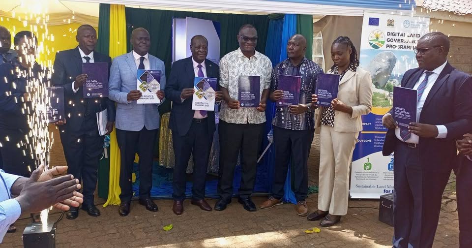
The president of Surveyors of Kenya, Mr. Eric Nyadimo, welcomed the move by Vihiga County to adopt GIS, saying it will help solve perennial land administration problems such as double allocation. Photo/Courtesy
By Ruth Sang
The launch of its new Geographical Information Systems data collection manual at the county levels has marked a major milestone in Vihiga County’s efforts to improve data management for better service delivery. This move will go a long way in digitizing operations and improving efficiency among various departments of the county.
Speaking during the launch, Governor Dr. Wilber Otichillo said the introduction of GIS technology was central to modernizing county functions. He expressed confidence that shifting to a digital system would streamline processes and provide a unified platform for service delivery. “We are going digital, and I am sure doing so will bring all county services into one system that will make it easier to handle,” he stated.
GIS Coordinator Dr. Betty Mulianga demonstrated how the GIS data are processed and put to use, pointing out that the system will greatly enhance accuracy and efficiency in handling county information. She said the manual will guide staff on how to collect, store, and apply geographic data in supporting planning and decision-making.
The president of Surveyors of Kenya, Mr. Eric Nyadimo, welcomed the move by Vihiga County to adopt GIS, saying it will help solve perennial land administration problems such as double allocation. “This is a major step forward for Vihiga. As a surveyor, I am so grateful and happy as it is going to simplify our work. I look forward to other counties following suit,” he said.
The Food and Agricultural Organization Deputy Director, William Hamisi, also joined in commending the digital shift by the county, adding that it would be of great benefit in agricultural development. He explained that the GIS mapping will enhance the implementation of government programmes like fertilizer subsidies, planning in the agricultural sector, and increased farm productivity. “This will map out the agricultural sector and help the government in programs like fertilizer subsidies, which eventually leads to increased farm produce,” said Hamisi.
The event attracted the attendance of senior county officials led by Deputy Governor Wilberforce Kitiezo, Director of GIS Mr. Washington Olando, County Chief Executive Committee Members, and other dignitaries. Their presence signaled strong institutional support for Vihiga County’s move toward digital transformation through GIS. The leadership of the county was optimistic that the new system will play a key role in solving administrative challenges, enhancing planning, and offering residents better services.