INVESTIGATIVE: The Half-Hour That Washed Away Dhunche, How a Missing Early Warning Pact Left Nepal Exposed
Foreign Minister Shisir Khanal told Parliament that timeline, but added a critical caveat: “We, however, need to verify this.”
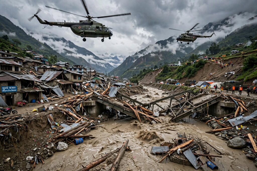
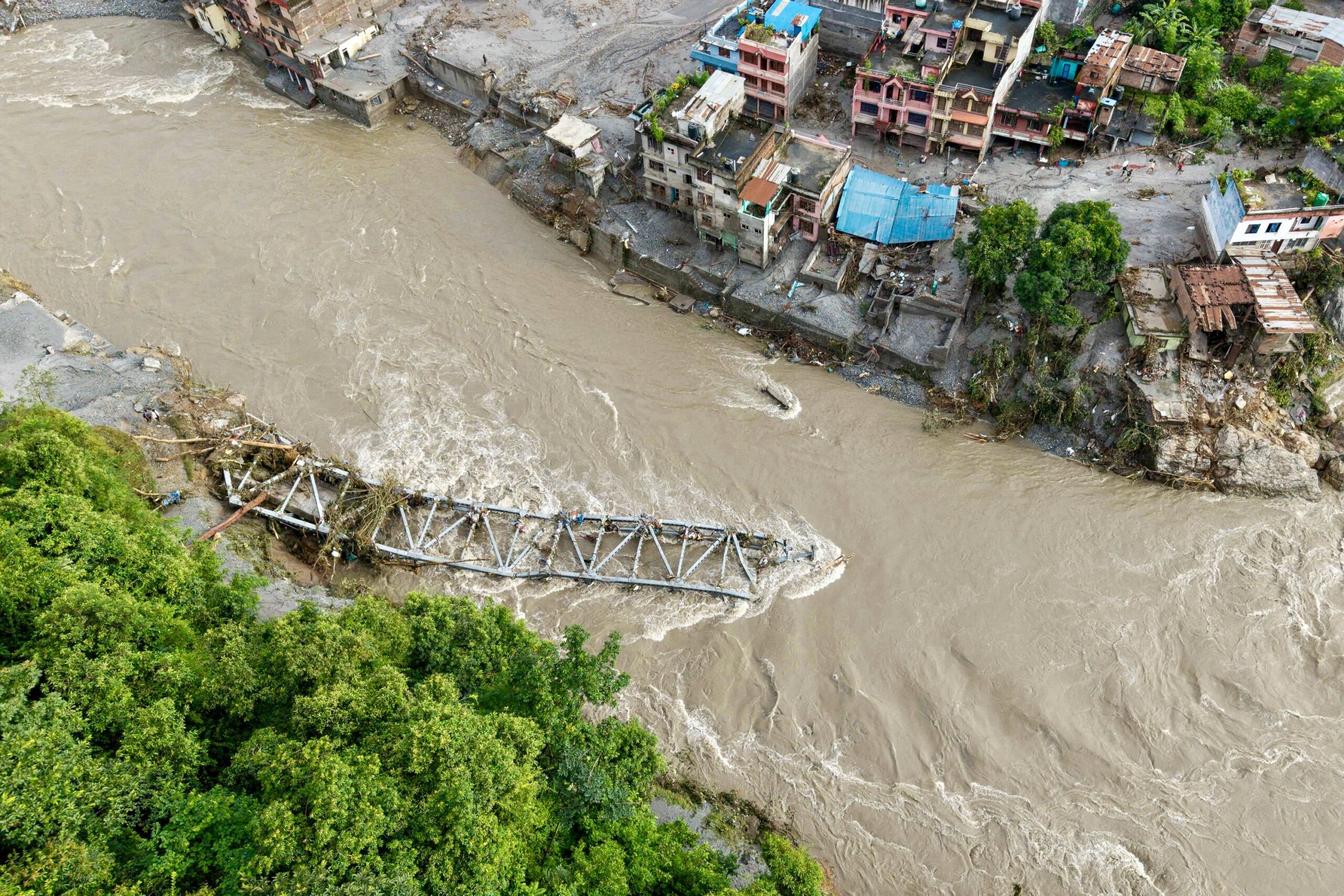
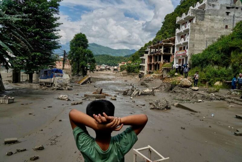
Dhunche flood aftermath.
By Robert Mutasi
DHUNCHE, Rasuwa
At 8:37 a.m. on Wednesday, a magnitude 4.4 earthquake shuddered through Tibetan territory, about 47 kilometres north of Gosainkunda, according to the US Geological Survey.
At 8:40 a.m. — three minutes later — a wall of water and debris tore into Nepal.
Foreign Minister Shisir Khanal told Parliament that timeline, but added a critical caveat: “We, however, need to verify this.”
What is not disputed is what happened next. A preliminary study based on Planet Labs satellite imagery by Nepal’s National Disaster Risk Reduction and Management Authority indicates that a debris-laden flood entered the Lhende river after a glacial-rock slide occurred along the Nepal-China border, about 20 kilometres northeast of the Rasuwagadhi border point. The flood then flowed through Timure and entered the Trishuli river.
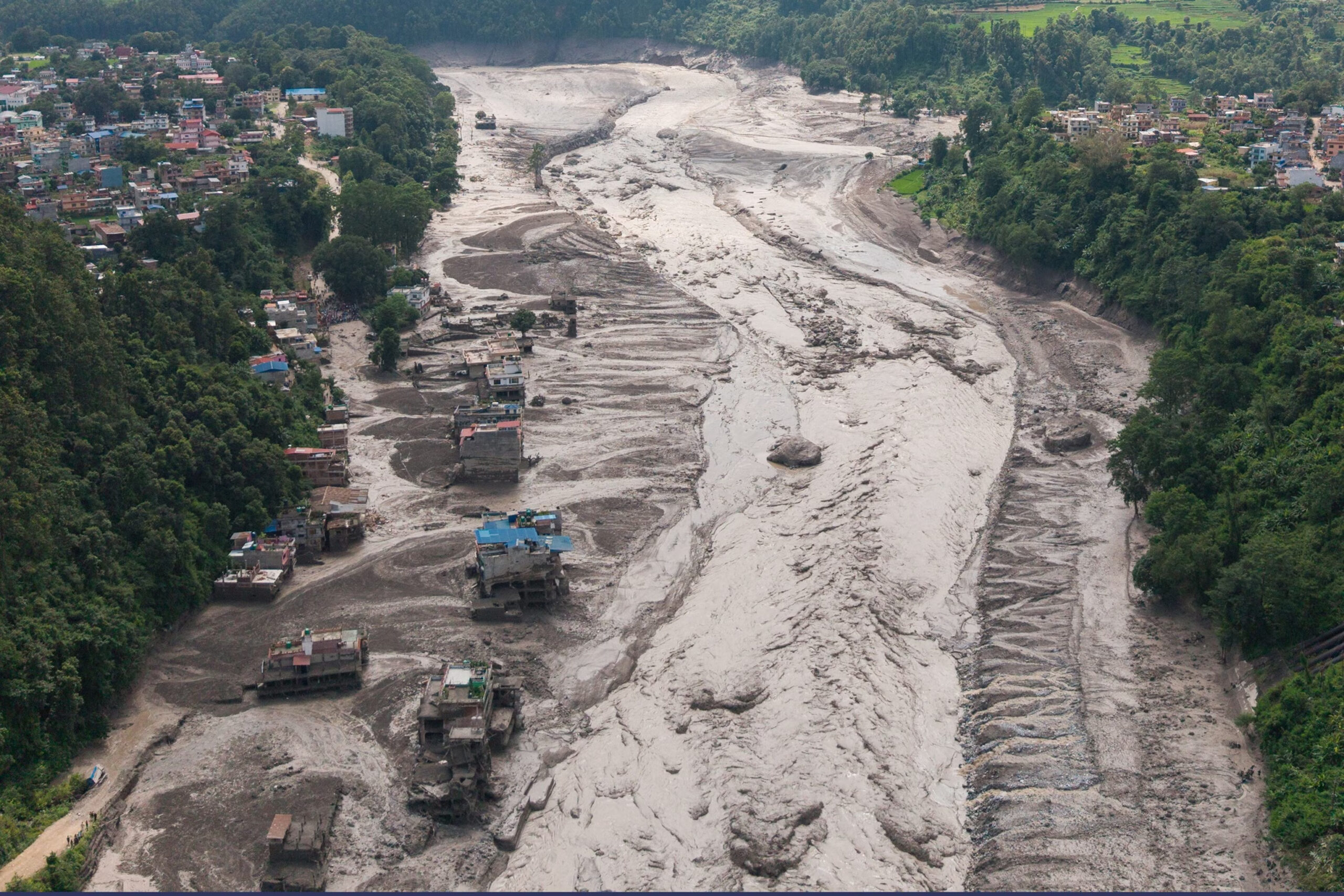
Within hours, the Bhotekoshi-Trishuli corridor was unrecognizable. The Miteri Bridge — the Friendship Bridge at Rasuwagadhi — was washed away again. Nineteen motorable bridges, forty kilometres of road, hydropower tunnels with workers inside, and whole towns in Rasuwa were gone.
The official count on Day 1 was seven dead. By Day 2, 95 bodies were recovered from flood-affected areas, with 85 security personnel — 44 from Nepali Army, 28 from Nepal Police, 13 from Armed Police Force — also missing, along with 60 hydropower workers and 484 tourists. Within days, before-and-after satellite images would show nearly 600 killed and more than 2,400 missing.
But the central question this investigation found is not what triggered the flood. It is why Nepal had no warning, even though this exact valley flooded a year ago — and why, when the world offered help to find the missing, Kathmandu said no.
Part 1: The Agreement That Was Never Signed
In July 2023, a lake formed on top of a glacier in China’s high mountains and burst 35 kilometres upstream from Rasuwagadhi. The surge rushed down Lhende Khola and Bhotekoshi, crossed the border and affected communities 80 to 100 kilometres downstream. At least 11 people were killed.
Following that incident, the two countries agreed to share cross-border real-time information on floods and landslides and flag potential risks of glacial lake outburst floods.
Our investigation found: No formal agreement has been signed to implement such a mechanism.
The issue was raised again during Foreign Minister Khanal’s visit to China in May 2026, but the two sides have yet to sign. The delay prompted concern among stakeholders over the absence of a functioning early-warning mechanism in a disaster-prone border region.
When this week’s flood hit, Nepal’s consul general in Lhasa, Laxmi Prasad Niraula, admitted: “The Chinese are also clueless about the reason behind the outburst.” He said neither Nepali nor Chinese authorities had been able to establish contact with security personnel deployed along parts of the border, leaving no authoritative information on what triggered the massive outburst.
In other words, the most dangerous river system on the Nepal-China border — a system that powers Nepal’s hydropower economy — is monitored by no joint gauge, no automated data feed, and no treaty.
Minister for Science, Technology and Innovation Mahabir Pun confirmed the gap to CNN-News18: “We could not get any warning from China as everything happened so fast. We have demanded an early warning system from China… Within half an hour of the dam, the flood reached Nepal. So, there was not enough time.”
He added: “Nepal and China currently have no agreement in place to share early warning information or relevant data from the Chinese side.”
Half an hour. That is the distance between life and death for tunnel workers in Rasuwa. And Nepal had no instrument upstream to buy that half hour.
Part 2: Why Foreign Teams Were Turned Away — The Tibet Factor
As bodies were recovered, offers poured in. The Kathmandu Post reported that India, China, the United States, Britain, Japan, South Korea, Sri Lanka and Bangladesh had asked the government to allow their search-and-rescue teams to assist.
Nepal’s foreign ministry said on Friday that it was managing rescue efforts itself. Spokesman Lok Bahadur Chhetri: “The offer for help is natural. Our security agencies are doing the search-and-rescue operation. For now we don’t require such help.”
At the time, nine South Koreans working in a hydropower plant were missing and 10 were stranded. South Korea said it had already sent a response team and would dispatch a disaster relief team, pledging $1 million. Seoul said Nepal had indicated it was not yet planning to accept foreign rescue teams and that it will keep negotiating.
Why refuse help when 391 foreign and 93 domestic tourists were out of contact, and 85 Nepali security personnel were missing?
Dinesh Bhattarai, a former Nepali ambassador to the United Nations in Geneva, told Reuters the reluctance may be linked to the location of the flood-hit Rasuwa district, which borders China’s Tibet, one of Beijing’s most sensitive territorial issues. Nepal has long walked a tightrope in diplomatic relations with its much bigger neighbour. “They may have thought about the locational sensitivity of the region and decided not to accept foreign teams,” Bhattarai said.
The foreign ministry denied that, saying the decision had nothing to do with China’s sensitivity but was because Nepal’s own rescue teams were handling the operation.
But Beijing’s shadow over the operation was visible. On Thursday afternoon, China’s No. 2 official, Premier Li Qiang, visited the disaster-stricken site in Gyirong on the Tibetan side. He directed rescue command to “strengthen coordination and communication on emergencies involving foreign nationals or foreign parties” and work with foreign authorities to determine those missing. President Xi Jinping extended condolences to Nepal’s president and ordered authorities to make every effort to search for and rescue missing people and to strengthen monitoring and early-warning systems.
The optics are stark: while Nepal insisted its army’s 12 helicopters and 15,000 personnel were enough — mobilized across Dhunche, Trishuli, Timure and Syabrubesi — the upstream cause lay in a region where even Chinese officials could not contact their own border personnel.
Part 3: The Hydropower Trap
Minister Pun made another admission that points to a deeper development model problem.
“Much more construction was happening on the Tibet side by China. Construction going on in Nepal was hydropower stations,” he said.[mainly]
Nepal’s geography forces this: steep Himalayan mountains mean most people live in river basins where flat land is available. Hydropower stations are built along rivers to produce power.
“Because of this geographical feature of Nepal, there are not many places with flat land where people can live above the river basin… More than 30 to 40 bridges have been washed away, and many schools and whole towns and villages have been washed away,” Pun said.
In this flood, that model collapsed. Workers were trapped inside tunnels. Custom offices were feared washed away. The very infrastructure meant to lift Nepal out of energy poverty became a death trap because there was no automated warning to evacuate tunnels when a lake bursts 20km upstream.
India, which has C-17 and C-130 aircraft with earthmoving equipment on standby, and the World Bank, which offered up to Rs25 billion in emergency assistance, have now told Nepal assistance will be based on its request. China has decided to provide immediate cash assistance. But as one finance ministry official noted, Nepal must first assess needs before formally seeking assistance — a protocol that slows aid when every hour counts.
What Could Have Saved Dhunche?
The technology exists — and has worked in Nepal.
DHM has installed a community-based flood early warning system to monitor small flash flood-prone rivers, with plans to replicate it. The system provides rainfall and flood levels data every ten minutes and sends SMS alerts to communities. Implementation of two systems reduced human casualties from 166 in 2017 to 27 in 2022 despite higher magnitude flooding.
Probabilistic forecasting could add five additional hours of warning, giving families crucial hours to get to safety.
Yet none of it was installed in the Lhende Khola.
The investigation shows a pattern: After every flood, Nepal and China agree in principle to share data. No treaty is signed. Construction continues in the floodplain. The next glacial lake bursts, and the cycle repeats.
For the 4,451 people who were rescued — including 191 pulled from tunnels and 517 rescued through 99 helicopter shuttle flights — the system worked, barely. For the hundreds still missing under debris in Dhunche, the half-hour warning that never came was everything.
The question for Kathmandu and Beijing is no longer whether another outburst will happen. Planet Labs imagery and Tibetan heavy rainfall in Manasarovar and Ali the night before already suggest it will.
The question is whether the next time the river rises at 8:40 a.m., there will be a gauge upstream that automatically screams — in Nepali, Chinese, and English — to get out of the river.

About Author