Shauri Estate Land Row Deepens: Records Show No Road, MCA Demands Probe into Conflicting Maps
“These two maps cannot both be right,” he said. “They must be subjected to investigative agencies to determine their authenticity once and for all.”Huruma Ward MCA Hon. Kimani Wanjohi
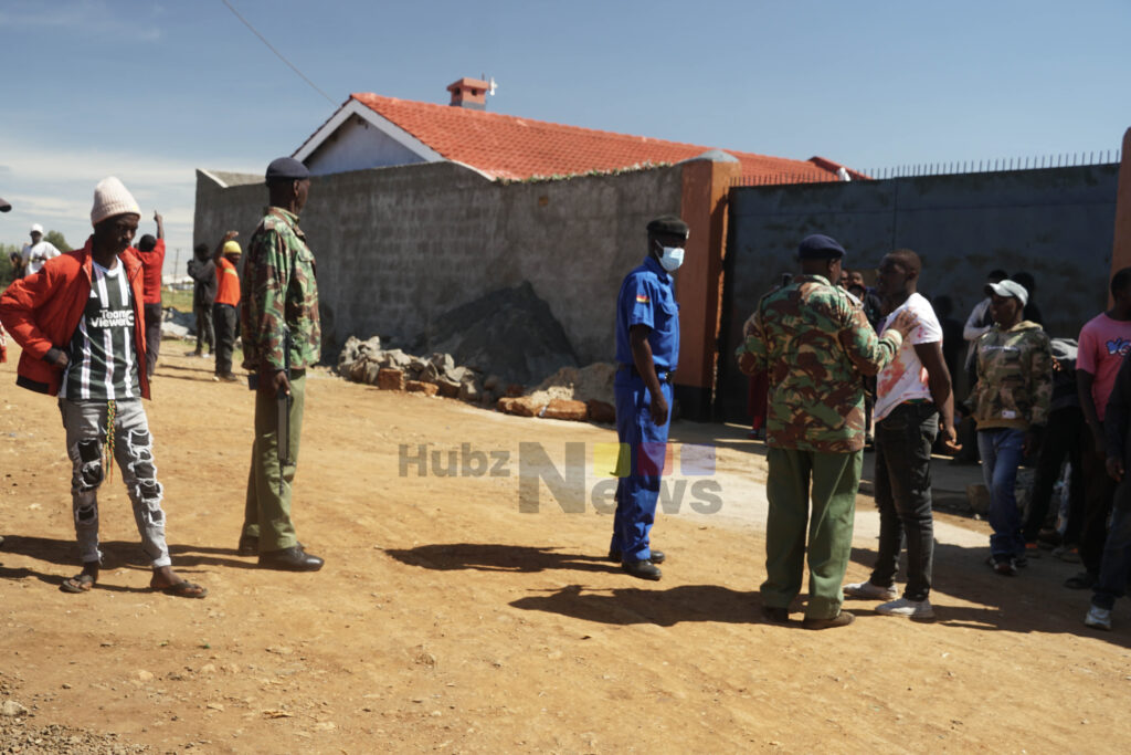
Police officers engage with residents at the contested Shauri Estate site as tensions rise over the disputed land ownership. Photo by Achieng Kemuma | Hubzmedia Digital.
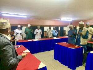
By Hubz Media Digital.
Official records accessed by Hubz Media from the County Survey Office, Uasin Gishu, indicate that no road passes through the disputed Shauri Estate parcel, even as leaders continue to clash over the land’s ownership and status.
The survey records, dated 23 September 2023, show that for Parcel No. Eldoret Municipality Block 1/18, all boundary beacons remain in their correct positions. The report—filed under Ref. No. CBRVOL XXIX/(161)—concludes that the parcel boundaries are intact and that no road traverses the land.
“All the boundary beacons were found in their correct positions. There is no road passing through the parcel,” reads part of the report signed by County Surveyor S.K. Langat.
The survey was carried out by officers Elisha Tanui and Japhet Bett, and approved by the Ministry of Lands, Public Works, Housing and Urban Development (State Department for Lands and Physical Planning) in accordance with the Survey Act, Cap. 299.
While the findings offer clarity on the technical status of the land, they do not fully resolve the political and public debate that has intensified in recent weeks.
Background: Tensions Flare Between MCA and Deputy County Commissioner
The Shauri Estate dispute has drawn sharp exchanges between Huruma Ward MCA Hon. Kimani Wanjohi and Turbo Deputy County Commissioner Edna Gesare, with both trading accusations over the handling of the matter.
In a public meeting last week, Wanjohi accused the assistant county commissioner of allegedly siding with individuals seeking to grab public land.
“The meeting that was called by the DCC turned chaotic. Goons were hired to intimidate residents, and when I rose to speak, I was denied a chance,” the MCA told residents.
Wanjohi further cited two conflicting maps — one showing the land as part of a road reserve, and another indicating private ownership — and questioned their credibility.
“These two maps cannot both be right,” he said. “They must be subjected to investigative agencies to determine their authenticity once and for all.”
However, Gesare dismissed the allegations, maintaining that her office’s role is strictly administrative and impartial.
“As government, we cannot and will not facilitate any form of land grabbing,” Gesare told Hubz Media.
“The meeting was purely a stakeholders’ engagement meant to bring all parties together and ensure transparency.”
Surveyor Mr. Cleofas, who had earlier inspected the area, affirmed that the land under dispute falls within a private boundary and does not overlap with any public utility road.
“Our technical findings indicate the parcel is privately owned and does not interfere with a public road reserve,” he noted.
Call for Transparency
Despite the official records accessed by Hubz Media appearing to favor the position that the land is privately held, the MCA insists that only an independent investigation can settle the matter. He warned that public trust and ongoing development initiatives in Shauri Estate, such as the Kenya Informal Settlements Improvement Project (KISIP II), could be jeopardized if the land question remains unresolved.
“If these plots are grabbed, Shauri Estate will lose out on vital development opportunities,” Wanjohi warned. “As long as I am the MCA, no one will take what belongs to the people.”
Local residents have echoed calls for the National Land Commission and the Survey of Kenya to step in and verify all survey maps and cadastral data related to the disputed parcel.